

Features かわさき防災アプリ
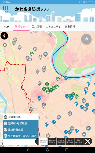
With the Kawasaki Disaster Prevention App, you can check a hazard map that shows dangerous areas such as floods, landslides, tsunamis, and inland waters on a map, as well as evacuation information that is being issued, evacuation center opening information, and evacuation center congestion status.
or list in real time.[Provided information and main functions]・In addition to Japanese, it supports simplified Chinese, traditional Chinese, English, and Korean.・When emergency information occurs, you will be notified by push notification・Equipped with various hazard maps and disaster prevention maps (partially compatible with offline)・ Real-time notification of evacuation information such as evacuation of the elderly, evacuation orders, and emergency safety assurance・Check the map for evacuation information that is being issued and evacuation center opening (congestion degree) information・Freely create a community and share information with family and friends
Secure & Private
Your data is protected with industry-leading security protocols.
24/7 Support
Our dedicated support team is always ready to help you.
Personalization
Customize the app to match your preferences and workflow.
See the かわさき防災アプリ in Action


Get the App Today
Available for Android 8.0 and above